The discovery trail
Step back in time as you explore the remains of the siege camps set up by Julius Caesar during the famous Battle of Alesia in 52 BC. This 16-kilometre walking trail invites you to follow in the footsteps of the Roman legions and Gallic warriors, amidst spectacular scenery where heritage and nature blend together.
Alesia: from one camp to the other
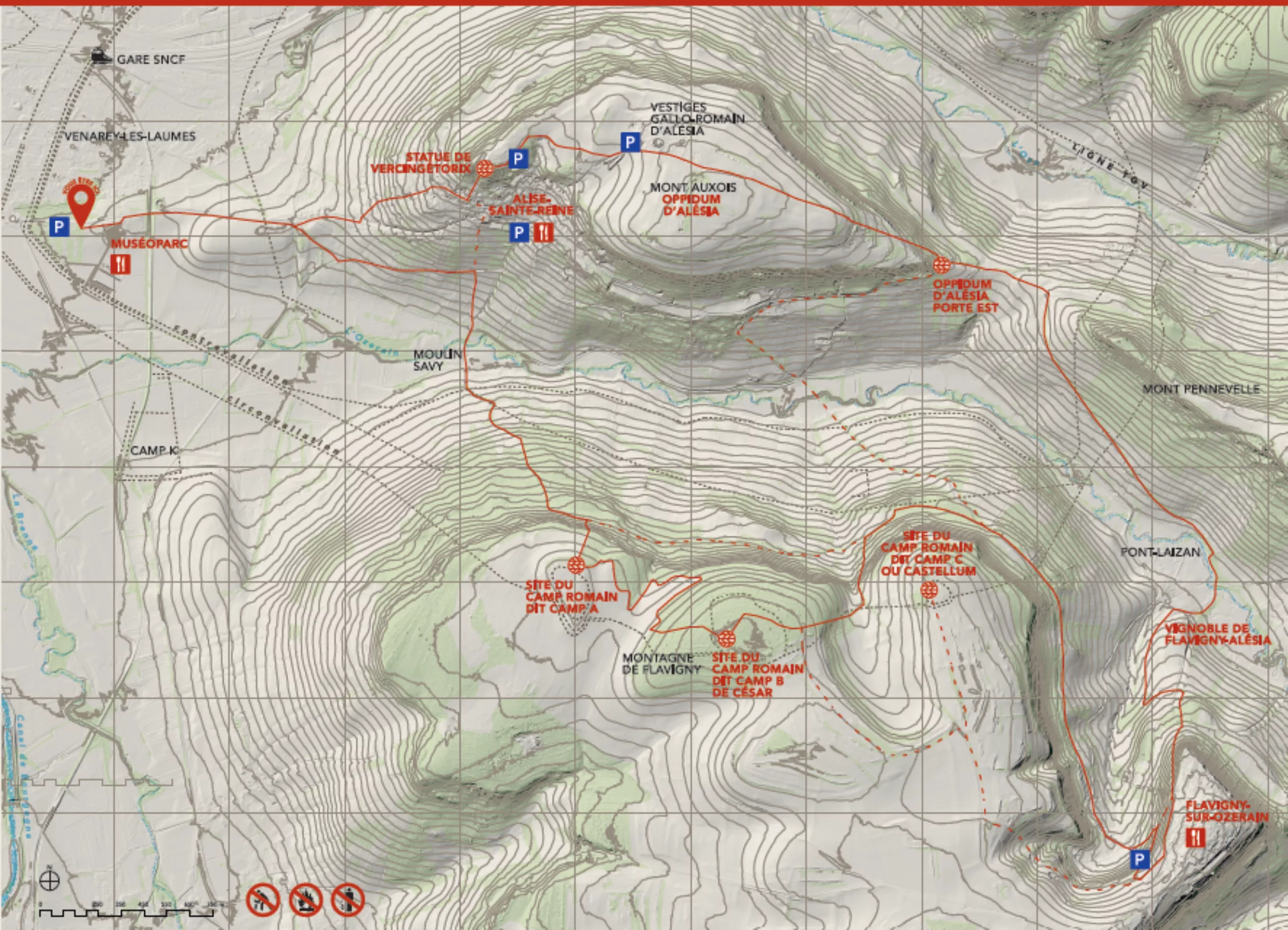
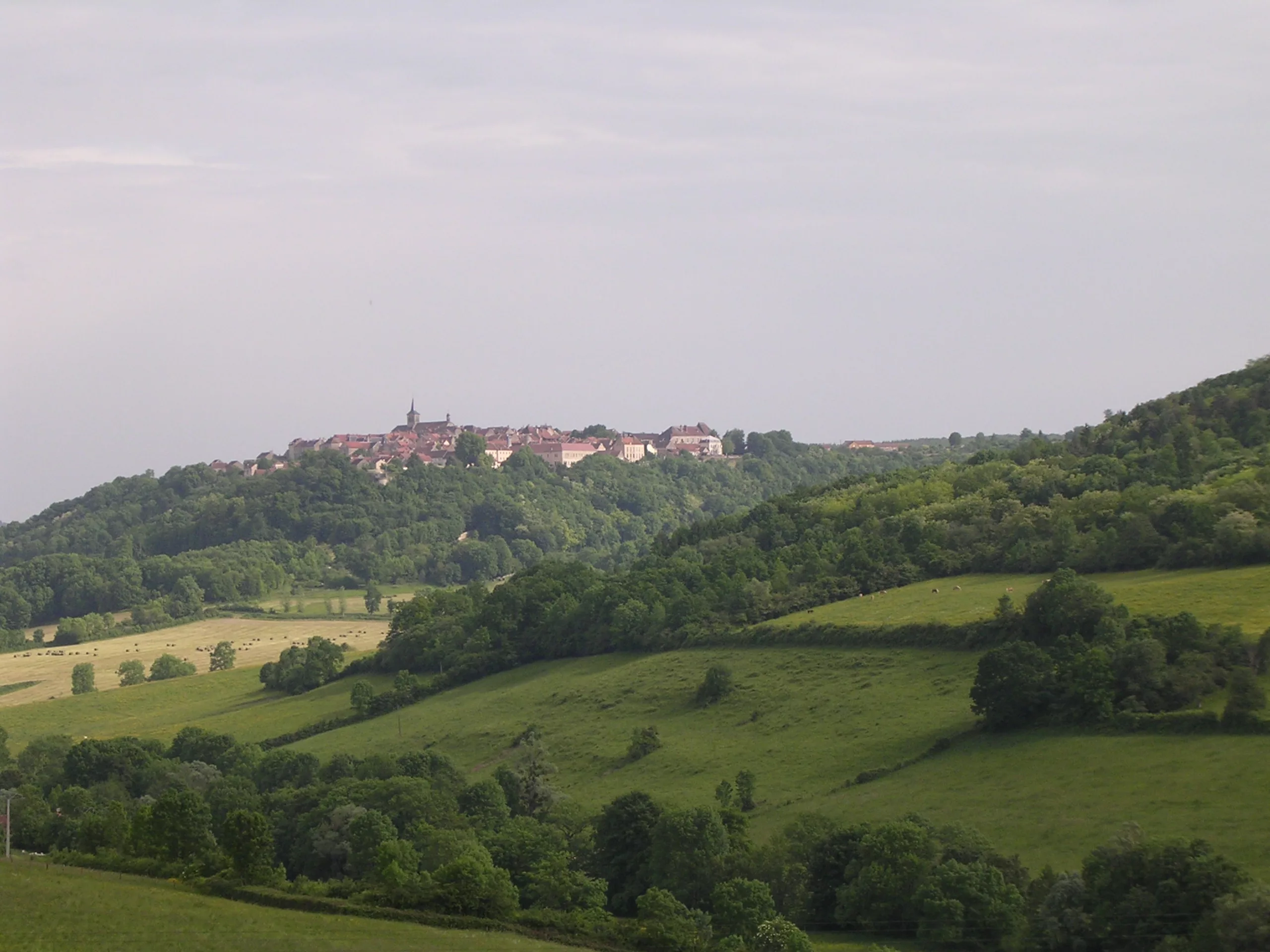
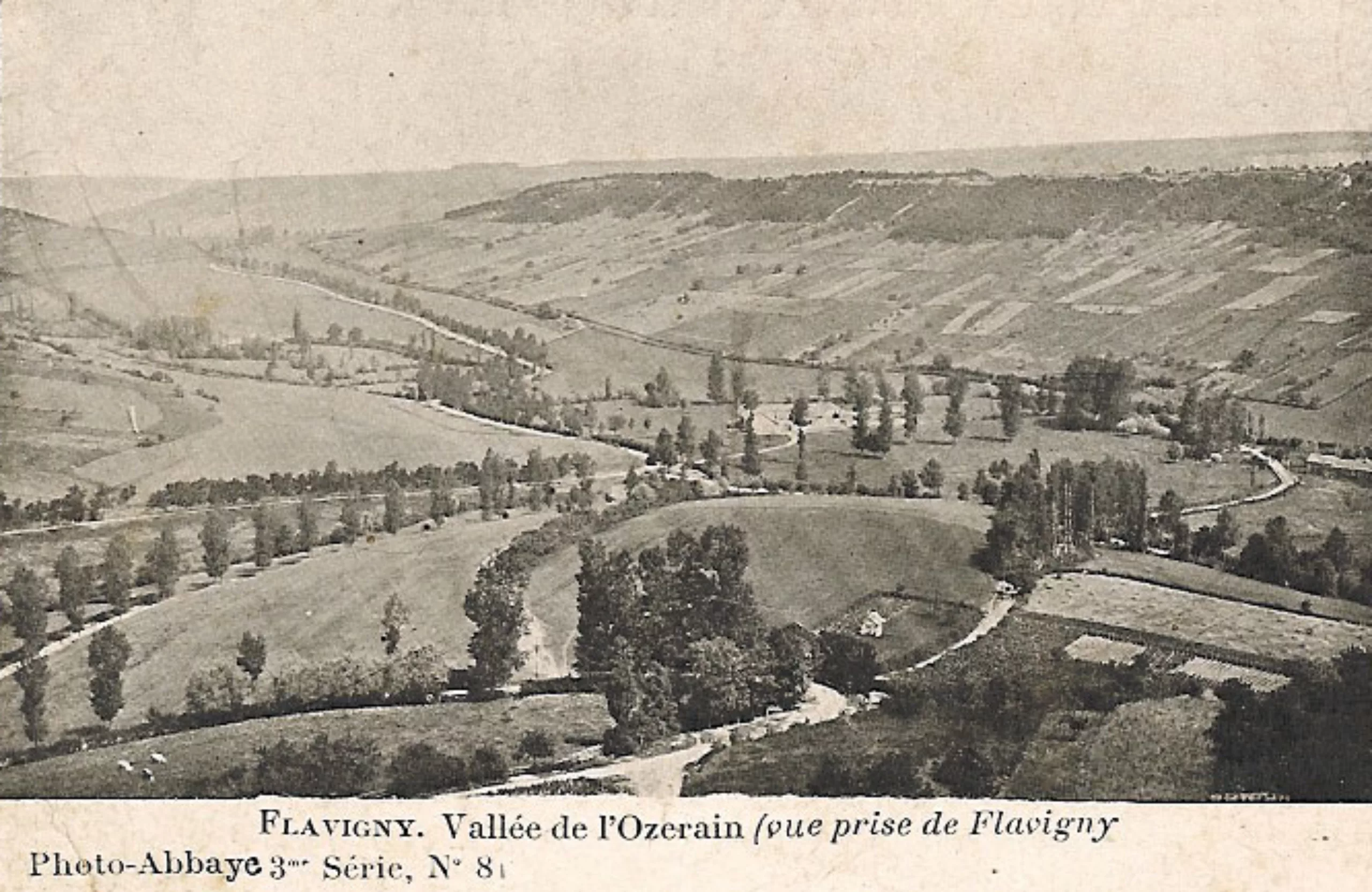
As you follow the route, discover the sites of Caesar’s ancient camps, strategically positioned around the Gallic oppidum. The route then takes you to the charming village of Flavigny-sur-Ozerain and its vineyard below, whose beauty and rich heritage are sure to captivate you. You’ll then pass through the oppidum, a veritable Gallic stronghold, before reaching the village of Alise-Sainte-Reine. You can admire the monumental statue of Vercingétorix as well as the remains of the Gallo-Roman town of Alésia, moving reminders of an exceptional past.
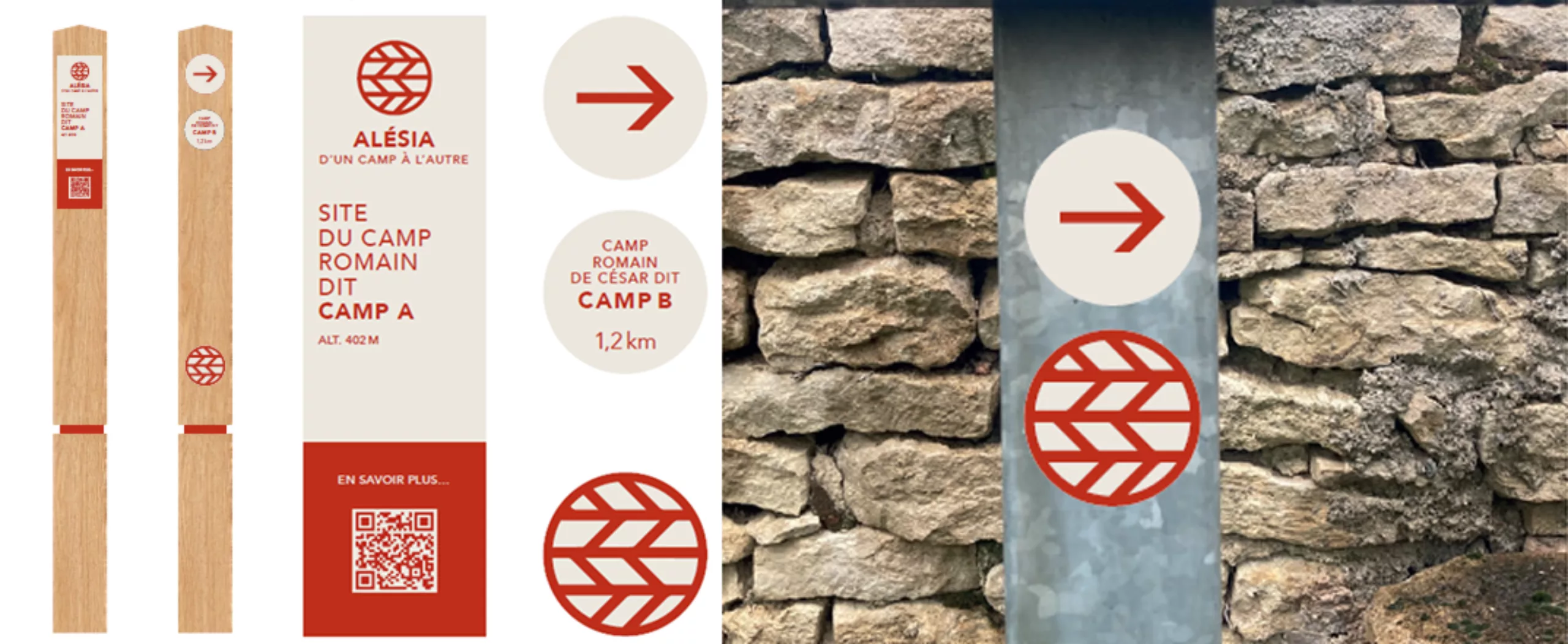
Clear signage and QR codes placed along the route will help you better understand the historical context and the points of interest you encounter.
-
- 52 BC: the date of the siege of Alesia
- 2 months: total duration of the siege
- 21 km: the length of the circumvallation (a line of fortifications protecting the Romans from an external attack by the relief army)
- 15 km: length of the counter-vallation (line of fortifications blocking the Gauls on Mont-Auxois)
- 7,000 hectares: total area of the site affected by the siege
- 3,000 hectares: area of the Alesia site enclosed within the Roman siege lines
- 10: Roman legions deployed at the time of the siege
- 80,000: Gallic infantrymen retreating into the oppidum of Alesia
- 150,000: people making up Julius Caesar’s retinue, comprising legionaries, slaves, women and children, and military equipment
Practical informations
- Free-access trail
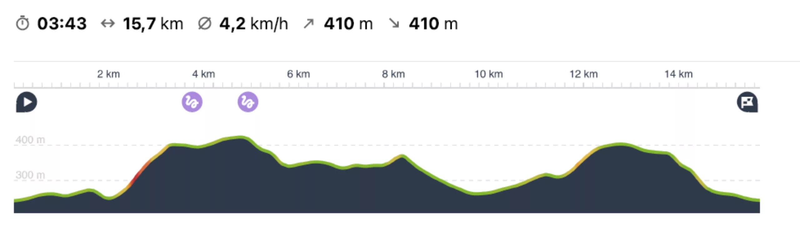
- Length: 15.7 km
- Elevation gain: 410 metres
- Difficulty level: moderate
- Approximately 95% on footpaths and 5% on roads
- Duration: 4 hours (without breaks). Allow around 5 hours
- You’ll need to be well equipped: walking or hiking boots, clothing suitable for the day’s weather, a supply of water, a packed lunch or snacks
- Three points with drinking water and toilets: MuséoParc Alésia at the start, La Fabrique des Anis de Flavigny halfway along the route, and the site of the Gallo-Roman city remains on the hills above Alise-Sainte-Reine
Map of the route
Markings and signage
Elevation profile
This trail was designed in collaboration with Ateliers Olivier Lesage (AOL) — a landscape architect and designer — the graphic design agency Les Pistoleros, and the agency Duc & Préneuf.
It is supported by the Côte-d’Or Departmental Council, the municipalities of Flavigny-sur-Ozerain and Alise-Sainte-Reine, the Pays d’Alésia et de la Seine, and Côte-d’Or Attractivité.
The 10 points of interest along the route
-
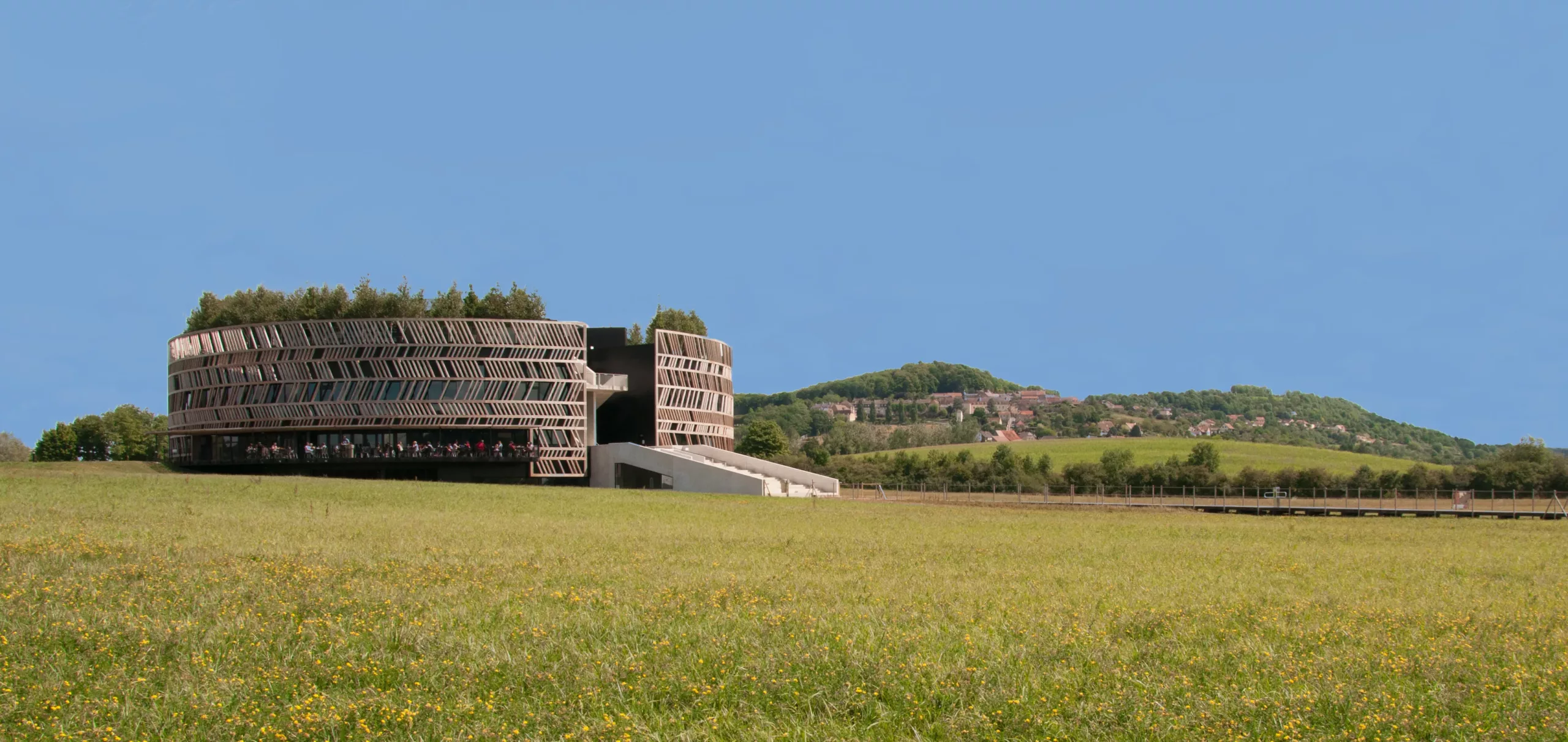 © Sonia Blanc
The current Alésia Museum is situated on the Plaine des Laumes, the site of the final clash between the Roman and Gallic armies. This contemporary building, designed by Bernard Tschumi, a Franco-Swiss architect, embodies a powerful dialogue between history and modernity. Its circular architecture symbolises the encirclement of the Gauls by Roman troops, whilst opening out onto the majestic surrounding landscape. Both massive and light in appearance, the building plays on the duality between the stability of Gallo-Roman civilisation and the chaos of war. The larch latticework structure evokes the fortifications built by Caesar. The building’s shape echoes the ancient defensive lines whilst offering a fluid, light-filled contemporary space. Inside, the permanent exhibition takes you on a journey through the site’s history, from the Neolithic period to the present day.
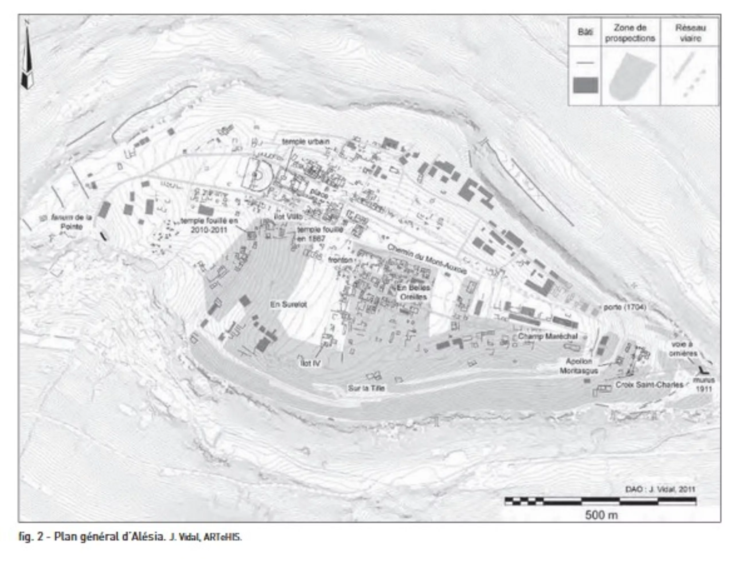
Outside, you can see a section of the reconstructed Roman fortifications stretching for around a hundred metres. The double fortification erected by Caesar measured 15 km for the contravallation (the inner line of fortifications that prevented the Gauls from leaving the oppidum) and 21 km for the circumvallation (the outer line of fortifications that protected Roman warriors from an attack by a relief army). These two lines of fortifications were punctuated by camps and small forts. Aerial surveys and excavations carried out in the 1990s brought to light this impressive defensive system, much of which had already been uncovered during the Napoleonic excavations in the 19th century.
-
On his arrival, and in accordance with the rules, Caesar set up his camps in a ring around the site of Alesia. As early as the time of Napoleon III, some of these camps had been identified and excavated. On the plateaus, this was not particularly difficult as earthworks were still visible; today, almost all of them have disappeared due to agricultural development, except for Camp B, where the southern rampart is still discernible in the modern landscape as a ridge of rubble.
Camp A occupies a strategic position at elevation 408; it covers 2.3 hectares and follows the contour lines perfectly, giving it the shape of a ‘dried bean’. Two gates are known: one to the north, protected by a clavicula (a quarter-circle barrier that blocks the passage through the gate from the rampart towards the interior of the camp), the other to the south, defended by a very deep ‘titulum’ (the ‘titulum’ is a ditch of the same width as the gate, dug in front of it). Favourable soil conditions have allowed the preservation of a fragment of a leather tent, which can now be seen in the museum.
The ditch of this camp has yielded a fairly abundant and characteristic collection of Roman artefacts, both military and civilian: a stone cannonball, an artillery projectile, as well as an amphora and a large metal ladle. The camp is defended to the south by two encircling ditches; there is no trap system in this area.
-
Camp B is situated on Flavigny Hill, to the south of the poliorcetic defences (associated with the siege), at an average altitude of 425 metres. Slightly larger than Camp C (7.3 hectares), it is also less well known, as aerial surveys and excavations have been hampered by a recently planted forest, preventing a complete view of the site.
Research carried out during the Second Empire suggests it was elliptical in shape. The camp’s rampart has been preserved by forestry work and now appears as a slight ridge of rubble, visible in the undergrowth. The circumvallation joins the fortification to the south.
Camp B was built on a limestone plateau. Only a single section on the southern flank has been excavated. The rampart, built of limestone slabs and approximately 6 metres wide, is clearly visible; it is punctuated by closely spaced wooden posts, which mark a succession of towers measuring approximately 3 x 3 metres at intervals of 7 metres. A V-shaped ditch runs along the front of the rampart. There is also a series of pits situated behind the rampart.
Various objects were found at the site: a herminette axe, characteristic of a legionary’s equipment and used for cutting stone and wood, and fragments of Roman portable millstones. Trap systems of the ‘Tribuli’ type were found, consisting of four iron spikes joined together and thrown onto the ground to hinder the advance of horses and Gallic warriors.
In accordance with Polybius’s standards, an area of approximately 7 hectares was sufficient to accommodate a unit of around 3,500 to 4,000 men, as was likely the case with Caesar’s Legion, whose numbers were probably somewhat reduced after so many battles by the end of the summer of 52 BC.
-
The castellum (a fortified settlement equivalent to a small camp), covering an area of approximately 0.9 hectares, is situated on the easternmost hill of the Flavigny mountain. It was the subject of limited trial excavations in 1991. A Roman pilum head (a type of spear) was found at the site.
The ditch is cut into the compact bedrock. A little further to the west, an aerial photograph by the archaeologist René Goguey reveals the presence of another fortification in the valley separating Castellum 11 from Camp B.
The three camps and the three castella (on the Flavigny side and the Bussy side) all share the feature of being within sight of one another and able to communicate by signals. All the camps and castella are surrounded by the circumvallation (outer line of fortification), which shows that the main concern was to ensure the security of the perimeter. From here, it was possible during the day to observe the movements of Gallic troops within the oppidum and to signal these to other units using optical means.
-
This medieval town, listed among the “most beautiful villages in France”, is also known for its aniseed sweets.
Historically, there is evidence of settlement dating back to the Neolithic period. It later became a strategic stronghold for Caesar’s troops during the siege of Alesia. During the Gallo-Roman period (following the Battle of Alesia), a villa (an estate comprising farm buildings and dwellings) and a castrum were established. This is when the town’s first attested place name appears: “Flaviniacum” from Flavinius – (i)accus: the place of Flavinius. Flavigny belonged to a Roman landowner. Around Flavien’s Gallo-Roman villa, craftsmen, traders and a whole agricultural community subsequently settled.
In 719, Widerard, a great Burgundian lord to whom Flavigny and its surroundings belonged, founded the Benedictine Abbey of Saint-Pierre, which today houses the relics of Saint Reine. It is also here that the Flavigny Aniseed Factory is located.
If you wish to visit the village, allow an extra 45 minutes to 1 hour on top of your journey time.
There are places to eat in the village; please refer to the “catering” section. Please note the opening dates and times of establishments during the low season
Drinking water supply point and toilets near the Anis de Flavigny shop
-
Winegrowing in Flavigny has a long history. The vineyard as it stands today was planted in 1994 and covers 14 hectares. Wine-growing in the Auxois region, and particularly in Flavigny, has not always been such a niche activity. Indeed, before the phylloxera epidemic, this part of Burgundy boasted several hundred hectares of vineyards. Furthermore, the wines produced enjoyed a certain reputation, as Henry d’Andeli’s map, drawn up in 1224 under Philip Augustus, lists Flavigny as a major centre of wine-growing in France.
This vineyard is one of the oldest in France (recorded before Charlemagne in 744). It was already known in Gallo-Roman antiquity and remained renowned, even as recently as the 19th century, as attested by Dr Morlot in 1830.
Today, six grape varieties are grown on these lands, including Chardonnay, Aligoté, Pinot Noiré and Pinot Noir.
For further information, please visit the estate’s website.
-
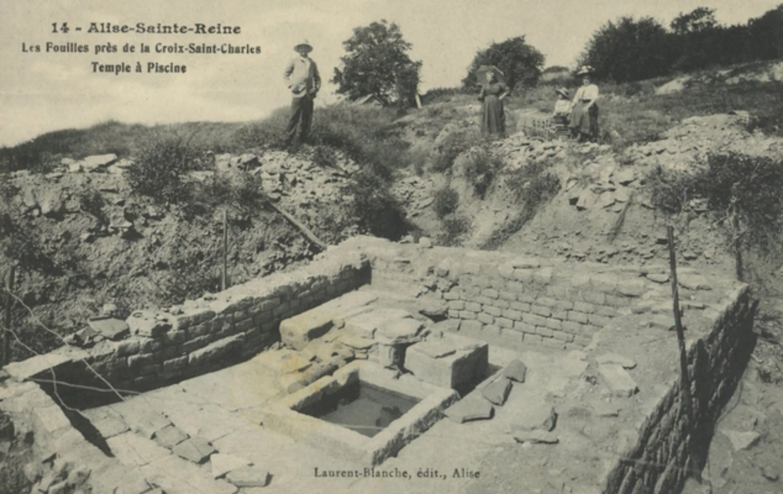
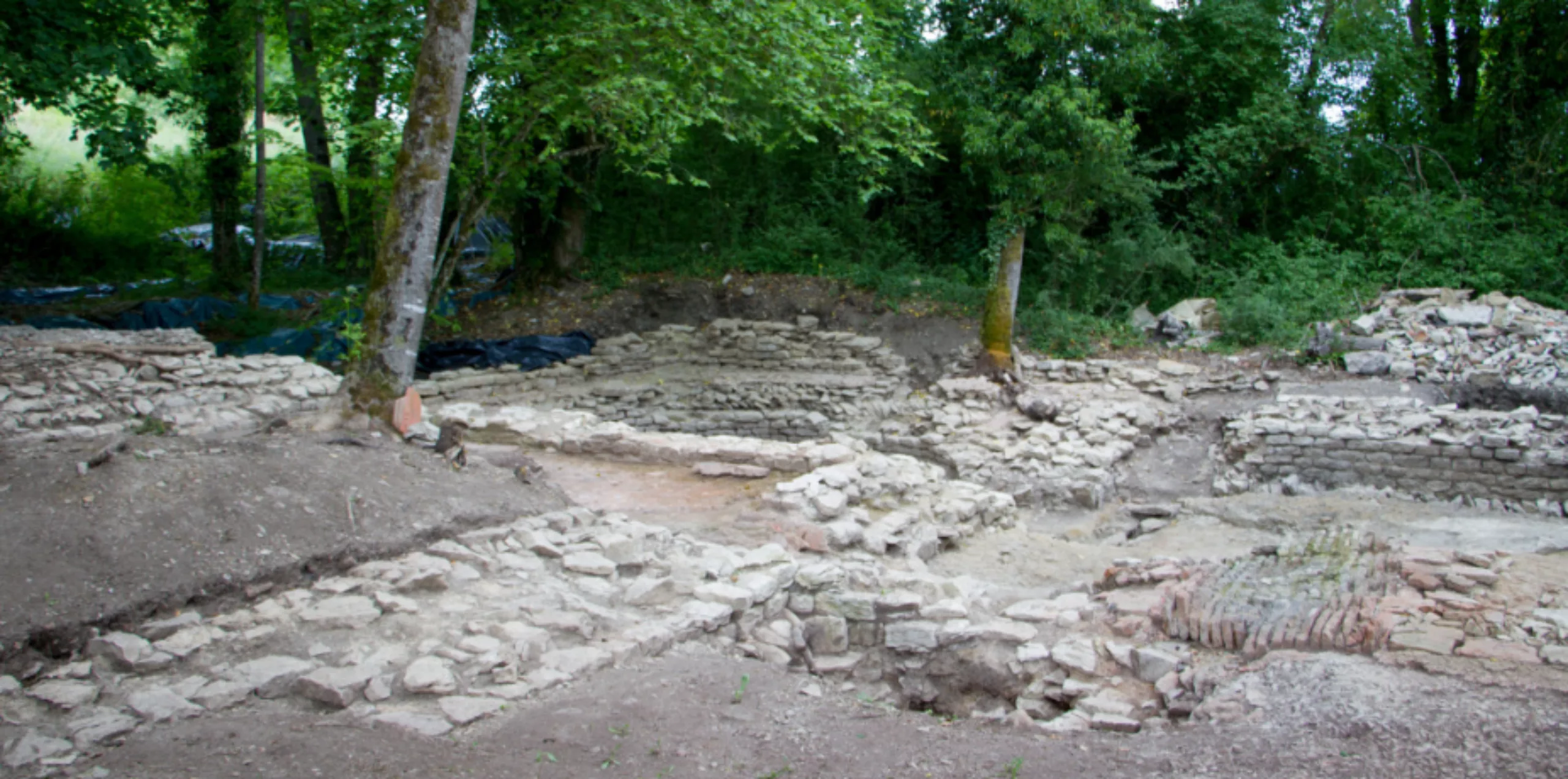
The oppidum at Alise-Sainte-Reine, a former stronghold, has been occupied since the early first century BCE. Archaeological finds indicate that the area has been continuously inhabited since ancient times. Two significant features are known: the existence of a murus gallicus-type rampart (Gallic rampart) and the presence of Celtic layers beneath the Gallo-Roman monumental centre. In 1911, a section of the rampart, 25 metres long and 6 metres wide, was discovered at a place known as Croix Saint Charles. The structure was subsequently excavated again between 1991 and 1994. A 3-metre-wide road made of gravel was also uncovered beneath the Gallo-Roman structures.
During the excavations led by Émile Espérandieu in 1908, an octagonal temple, thermal baths, various pools and ancillary buildings from the Gallo-Roman period were uncovered. Inscriptions reveal the name of the tutelary deity, Apollo Moritasgus.
Until 2018, an excavation programme known as the “Alésia Sanctuary”, funded by the Ministry of Culture, enabled an extensive geophysical survey covering 42.5 hectares – nearly half of Mont Auxois – which made it possible to draw up a new map of the settlement.
In 2010 and 2011, the programme focused on the major place of worship dedicated to Apollo Moritasgus at the eastern tip of the plateau, at a place known as La Croix Saint Charles. In 2015, the discovery of a network of pipes and basins confirmed the site’s status as a water sanctuary. The water was used for religious rituals and for the public baths. The temple of Apollo Moritasgus yielded a collection of over 300 Gallo-Roman votive offerings found on this 1,900 m² site, which were probably affixed to a peribolos wall (the outer wall enclosing the space around a temple).
The 11 excavation campaigns carried out between 2008 and 2018, led by Olivier De Cazanove (Professor Emeritus of Roman Archaeology, University of Paris-Panthéon-Sorbonne), have provided a radically new understanding of the sanctuary compared with the excavations carried out a century earlier. Deposits of animal remains found in ditches date from before Caesar’s conquest.
At present, the excavations at Croix Saint-Charles are no longer visible on site. Inside the museum, you will find objects unearthed there and an account of these discoveries.
-
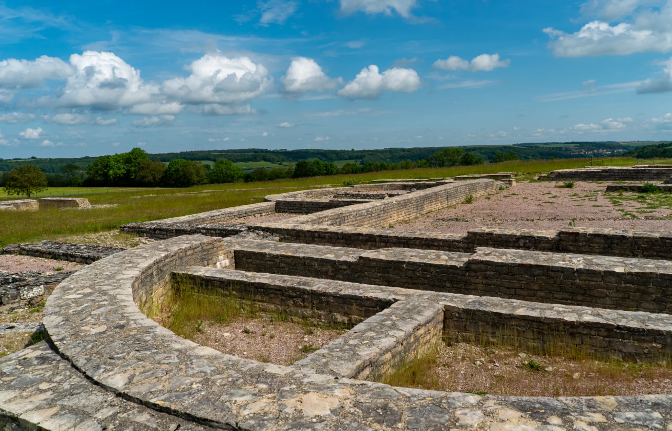
On the plateau lie the visible remains of the ancient Gallo-Roman town, which replaced the former Gallic settlement of the Mandubians.
Following the defeat of Vercingetorix, the oppidum of Alesia was therefore not destroyed and continued to be inhabited. During the 1st century AD, a prosperous Gallo-Roman town developed, following the model spread by Rome throughout the Empire, thanks in particular to the work of craftsmen specialising in bronze work. The population at that time is estimated to have been several thousand people. Today, only levelled ruins remain. These consist of the foundations and buried structures of the monuments and dwellings built over several centuries.
If you’d like to visit the site of the Gallo-Roman city remains, allow an extra 45 minutes to an hour on top of your journey time; dates and opening times are available here.
You can also take a relaxing break (cold and hot drinks are available at the visitor centre).
There is a water supply point and toilets in the visitor centre.
-
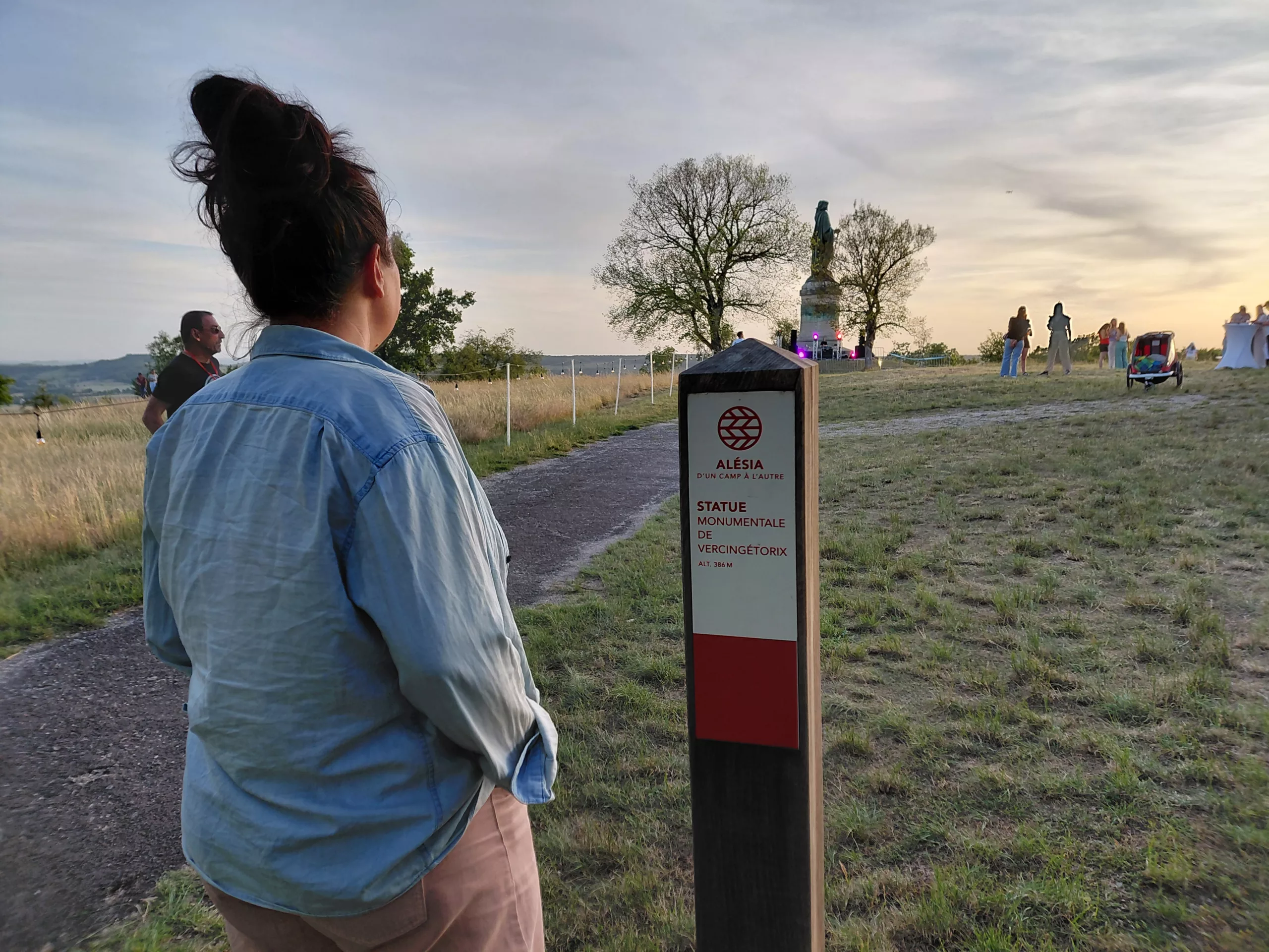
The colossal statue of Vercingétorix, standing 6.60 m tall and set on a 7 m plinth, carved from Saulieu granite and Pouillenay limestone, and designed by the architect Eugène Viollet-le-Duc, is truly awe-inspiring! Napoleon III commissioned the sculptor Aimé Millet to create it to commemorate the success of the archaeological excavations undertaken at Alésia.
Since 1865, this work, crafted from hammered and riveted copper sheet, has stood to the west of Mont-Auxois in the commune of Alise-Sainte-Reine. Situated a few hundred metres from the Gallo-Roman remains on the oppidum, it is a must-see during any visit to Alésia.
The sculptor Aimé Millet depicts Vercingétorix as defeated, resigned yet proud, in an introspective pose. This stands in some contrast to the inscription on its plinth: “A united Gaul, forming a single nation, animated by a common spirit, can defy the universe – Napoleon III in memory of Vercingétorix”
-
From the early Middle Ages onwards, the upper part of the oppidum was abandoned and the village settled on the slopes of Mont-Auxois. The ancient city of Alesia, now abandoned, then became a stone quarry, with its various buildings being dismantled over the centuries to provide building materials for, amongst others, the present-day village of Alise-Sainte-Reine and the village of Flavigny.
The name Alise-Sainte-Reine bears witness to two major historical events:
- “Alise” to evoke Alésia and its Gallo-Latin epigraphic inscription ‘ALISIIA’, which can currently be seen in the museum.
- “Sainte Reine” in memory of the young Christian martyr, Reyne, the French rendering of her original name, Regina. Two centuries after the battle, in 253, Reyne, a young Christian shepherdess, refused to renounce her faith and decided not to yield to the advances of a Roman governor. She was martyred and beheaded. From the following century onwards, a cult developed around her.
More recently, the village was the birthplace of Félix Kir, another local son, on 22 January 1876. Canon Kir, elected mayor of Dijon in 1945, died in 1968. He is buried in the Mont-Auxois cemetery.
If you’d like to visit the village, allow an extra 45 minutes to an hour on top of your journey time
To explore the village and all its iconic landmarks, please consult the guidebook.